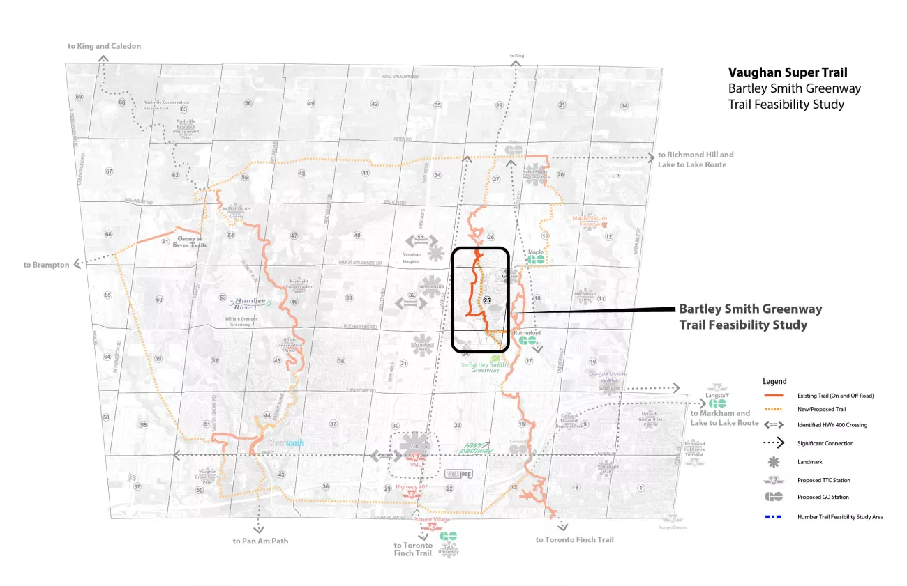
About Bartley Smith Greenway Trail
The Bartley Smith Greenway (BSG) is a 15 kilometre trail system that follows the West Don River. It is a recreational, multi-use trail that is a key component of the Vaughan Super Trail, a world-class 100-kilometre-long, city-wide trail network that connects users to nature, cultural heritage, communities and special destinations throughout the City of Vaughan. The trail system begins at the intersection of Steeles and Dufferin and reaches the north at Teston and Cranston Park. Future plans include extending the trail further north to Kirby Road.
The regeneration of the Bartley Smith Greenway was first initiated by a donation from the estate of Anne Bartley Smith and her husband, Matthew Smith. They were avid environmentalists who contributed to various reforestation and environmental projects in York Region and Toronto. A donation from the estate of Anne Bartley Smith sparked the West Don River Rehabilitation Project. In 1996, the rehabilitation project was later named Bartley Smith Greenway and adopted by TRCA who worked with partners including the Province of Ontario and City of Vaughan. Support from the Great Lakes Clean Up Fund, members of the EcoPark Steering Committee, the Conservation Foundation of Greater Toronto and other stakeholders were crucial to the development of the greenway.
To advance the Greenway, TRCA worked with partners to provide a continuous linkage of the trail system, establish trail management agreements and funding sources. As the implementation plan progressed throughout the years, various initiatives were completed such as retrofit projects, naturalization efforts, trail construction and community outreach programs. To date, the City of Vaughan and TRCA continue to create a continuous trail system and work on environmental rehabilitation within the corridor.
The Final Feasibility Study Report is available online and includes an overview of public engagement, research and technical studies and industry best practice. The Feasibility Study also gathers information, identifies and evaluates options to connect the route between McNaughton Road and Rutherford Road, and establish a preferred trail route providing a continuous pedestrian and cycling trail.
Once complete, the Bartley Smith Greenway will run continuously from Teston Road in the north to and Steeles Avenue in the south, supporting natural and cultural heritage, recreation opportunities, cycling, tourist destinations and overall well-being of residents. The Feasibility study looked at different crossings with the upper West Don River corridor to connect local neighbourhoods and communities, while examining ways to find a balance between current and future transportation needs of those who travel to and through the area, while respecting nature.
For more information on the Bartley Smith Greenway, download the Bartley Smith Greenway information sheet (PDF). You can also review some Frequently Asked Questions about the Bartley Smith Greenway Trail Feasibility Study and watch a video about connecting the gaps on the Bartley Smith Greenway Trail.
Study Location