Explore Vaughan by foot or bike
Image
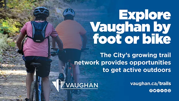
The City’s growing trail network provides opportunities to get active outdoors
Walk, ride or roll through your community neighbourhoods, parks and trails this spring! Vaughan is home to a growing network of sidewalks, cycle tracks, bike lanes, multi-use paths and recreational trails, and the City is proactively taking steps to promote and advance active transportation in the community. In addition to creating an integrated and connected city, this network offers an opportunity for residents to enjoy the outdoors and discover local neighbourhoods, nature walks and trail sites, all while getting active.
As outlined in Vaughan’s Active Transportation Annual Report, efforts are being made to create a full range of options for citizens to get around, including walking, cycling and transit. In addition, the recently completed 2020 Pedestrian and Bicycle Master Plan Update features 10 years of lessons learned and research gathered with the objective of creating an active city and fostering a more walkable and bikeable Vaughan. Examples of some of these initiatives include the Great Walks of Vaughan program and the Vaughan Super Trail network.
GREAT WALKS OF VAUGHAN
The City’s award-winning Great Walks of Vaughan program includes the following 12 trails throughout the community:
- Jersey Creek Neighbourhood Walk: This 2.6-kilometre trail wraps along Jersey Creek Park, Chancellor Park and Giovanni Caboto Park, and includes local playgrounds, a splash pad, sports fields and picnic areas. What makes this trail unique is that it features a dinosaur-themed sandbox and outdoor fitness equipment. It is ranked at an “easy” difficulty level due to its paved and lit terrain. For photos and more information, visit the Jersey Creek Neighbourhood Walk webpage.
- Mackenzie Glen Neighbourhood Walk: This 3.2-kilometre trail is part of the Bartley Smith Greenway and wraps around Cunningham Pond and Maple Lions Park, and features local playgrounds, splash pads, sports fields and picnic areas. It is ranked at an “easy” difficulty level due to its paved, flat and lit terrain. For photos and more information, visit the Mackenzie Glen Neighbourhood Walk webpage.
- Maple Nature Reserve Nature Walk: This 3.2-kilometre looped trail features an immersive nature experience over 35 hectares, including many opportunities for unique flower, plant and wildlife sightings. It is ranked at an “easy to moderate” difficulty level due to some rugged terrain and steep inclinations. For photos and more information, visit the Maple Nature Reserve Nature Walk webpage.
- Marita Payne Neighbourhood Walk: This 2.5-kilometre looped trail is part of the Bartley Smith Greenway and wraps around Marita Payne Park and Glen Shields Park. It is ranked at an “easy” difficulty level due to its paved, flat and lit terrain. For photos and more information, visit the Marita Payne Neighbourhood Walk webpage.
- North Maple Regional Park Nature Walk: This five-kilometre trail is situated over 80 acres in the park and is surrounded by the natural landscapes of the Oak Ridges Moraine and the Don River. This trial is accessible and is ranked at an “easy to moderate” difficulty level due to its granular surface and some sloped areas. For photos and more information, visit the North Maple Regional Park Nature Walk webpage.
- Peter Rupert Neighbourhood Walk: This 2.8-kilometre trail wraps around Golden Forest Pond, Cook Woodlot and Pheasant Hollow Park, and includes playgrounds, sports fields and picnic areas. Visitors can enjoy scenic landscapes, birdwatching and there is also a cycling path. It is ranked at an “easy” difficulty level due to its linear, flat and paved terrain. For photos and more information, visit the Peter Rupert Neighbourhood Walk webpage.
- Rainbow Creek Neighbourhood Walk: This 2.2-kilometre trail extends from Mapes Park and Rainbow Creek Park and wraps around the local playground, sports fields and picnic areas. It is ranked at an easy difficulty level due to its linear, paved and lit terrain. For photos and more information, visit the Rainbow Creek Neighbourhood Walk webpage.
- Riverwalk Neighbourhood Walk: This 1.7-kilometre looped trail extends along the Humber River and Nort Johnson Park, passing picnic areas, sports fields and the seasonal Woodbridge Village Farmers Market. It is ranked at an easy difficulty level due to its lit and paved terrain with moderate inclination. For photos and more information, visit the Riverwalk Neighbourhood Walk webpage.
- Sonoma Heights Neighbourhood Walk: This 2.6-kilometre trail wraps around the Sonoma Greenway and the area’s sports fields, a skate park, a playground and a splashpad. It is ranked at an “easy” difficulty level due to its linear, flat, paved and lit terrain. This trail is also accessible around Sonoma Heights Park. For photos and more information, visit the Sonoma Heights Neighbourhood Walk webpage.
- Sugarbush Nature Walk: This 2.4-kilometre looped trail features natural landscapes within a woodlot, a playground and community gardens. The historic Baker House is also on site. It is ranked at an “easy” difficulty level due to its mostly flat terrain. For photos and more information, visit the Sugarbush Nature Walk webpage.
- Vellore Neighbourhood Walk: This 4.7-kilometre looped trail features scenic views around the pond and woodlot areas, heritage sites such as the Vellore Heritage Park, hall and school, and paths along playgrounds, sports fields, splash pads and picnic areas. It is ranked at an “easy” difficulty level as some trail areas are lit and paved. For photos and more information, visit the Vellore Neighbourhood Walk webpage.
- William Granger Greenway Nature Walk: This 8.9-kilometre trail extends from Bindertwine Park to the Boyd Conservation Area and features natural landscapes with unique flowers, plants and wildlife. It is ranked at a moderate difficulty level due to some rugged terrain and steep inclinations. For photos and more information, visit the William Granger Greenway Nature Walk webpage.
For more information, visit vaughan.ca/GreatWalks. A Great Walks of Vaughan walking trail guide (PDF) and the City’s Great Walks of Vaughan map legend (PDF) are also available.
Things to remember while walking outdoors
When walking on a community trail, remember to:
- cross only at marked crosswalks or traffic lights, not in the middle of the block or between parked cars.
- ensure drivers see you before you cross and watch for traffic turning at intersections or entering and leaving driveways.
- never cross on a red light.
- wear bright clothing or reflective strips when walking at dusk or at night.
- stay on designated trails.
- be courteous to other trail users by keeping to the right.
- keep all pets on a leash and be sure to pick up after your pet.
- do not disturb any plants or wildlife.
- hold on to litter until you can dispose of it in a garbage bin.
- follow York Region Public Health guidelines, including practising physical distancing and wearing a mask outdoors if a two-metre distance cannot be maintained.
VAUGHAN SUPER TRAIL
The planned Vaughan Super Trail is a 100-kilometre city-wide loop system of which 40 per cent already exists. The initiative contributes to the ongoing development of an integrated, accessible and sustainable city, placing Vaughan at the forefront in offering residents and visitors an enhanced quality of life while creating a variety of recreational opportunities and visitor experiences.
The initial concept for the trail was endorsed by Council in April 2017 through the City’s Cycling and Pedestrian Advisory Task Force – the primary role of the network is to provide opportunities for active or passive recreation within existing neighbourhoods, link major open space features and destinations and provide local active transportation routes for work, school and small trips within the community. Details are further outlined within the City’s 2020 Pedestrian and Bicycle Master Plan update.
City staff continue to work on the Vaughan Super Trail planning, design and development initiatives, including:
- completing the seven-kilometre Humber Trail feasibility study, connecting to the city of Toronto from Steeles Avenue to the Boyd Conservation Area Trail. Virtual public engagement opportunities will be launched in the coming months.
- starting a feasibility study in the spring of 2021 to fill a three-kilometre trail gap along the Bartley Smith Greenway between Rutherford Road and McNaughton Road, utilizing the recently completed Major Mackenzie Drive pedestrian underpass. Multiple public engagement touchpoints will be conducted throughout the study.
- collaborating with York Region on a feasibility study for the South York Greenway Cycling and Pedestrian Corridor in the vicinity of the Highway 407 corridor. When complete, the entire length of the South York Greenway will span approximately 40 kilometres from Vaughan to the eastern limits of Markham. The Vaughan corridor segment will span approximately 23 kilometres, with the first phase measuring approximately 11 kilometres between Jane and Yonge streets. The study is underway and multiple public engagement touchpoints will be conducted.
- undertaking a wayfinding and signage request for proposal for the Vaughan Super Trail in late 2021 that will provide a trail branding strategy, wayfinding and signage guidelines for recreational trail signage.
- reviewing opportunities to expand the multi-use recreational trail network within North Maple Regional Park.
- undertaking a master plan for the MacMillan Farm to provide public recreational trail networks throughout the site.
Cycling safety tips and etiquette
Did you know a bicycle is considered a vehicle under the Ontario Highway Traffic Act (HTA)? This means cyclists have the same rights and responsibilities to obey all traffic laws as other road users. Cyclists are also required to wear a helmet if under the age of 18 and have the following on their bike:
- white reflective tape on the front forks
- red reflective tape on the rear forks
- a white front light
- a red rear light or reflector
- a working bell or horn
When sharing space with pedestrians, cyclists should:
- keep to the right.
- pass on the left when safe to do so.
- yield to pedestrians.
- let pedestrians know they are approaching with a friendly greeting or by ringing their bell.
When riding on the road, cyclists should:
- travel in the same direction as motorists.
- stop at traffic lights and stop signs.
- use hand signals to communicate their intentions with motorists and pedestrians.
Learn more at vaughan.ca/cycling and vaughan.ca/trails.
Vaughan’s growing pedestrian, cycling and multi-use recreational trails network aligns with the City’s commitment to improve transportation and mobility, foster sustainable communities and create an active, safe and diverse city – all priorities outlined in the 2018-2022 Term of Council Service Excellence Strategic Plan.
-30-