Explore Vaughan by foot or bike this fall
Image
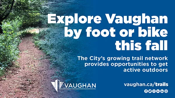
The City’s growing trail network provides opportunities to get active outdoors
Walk, ride or roll through your community neighbourhoods, parks and trails this fall! Vaughan is home to a growing network of sidewalks, cycle tracks, bike lanes, multi-use paths and recreational trails, and the City continues to take steps to promote and advance active transportation options.
As outlined in Vaughan’s Active Transportation Annual Report, efforts are being made to create a full range of options for citizens to get around, including walking, cycling and transit. In addition, the recently completed 2020 Pedestrian and Bicycle Master Plan Update features 10 years of lessons learned and research gathered to create an active city and foster a more walkable and bikeable Vaughan. Examples of some of these initiatives are below.
CYCLING AND MULTI-USE RECREATIONAL TRAILS NETWORKS
The cycling and multi-use recreational trails network in Vaughan is growing and consists of the following:
- Cycle tracks: designated space for cyclists that are separate from pedestrians and motorists. These areas are marked with a bicycle symbol and diamond.
- Bike lanes: designated space for cyclists that are separate from pedestrians but run along the same road as motorists. These areas are made visible with pavement markings.
- Multi-use Pathways: shared space for pedestrians and cyclists that are separate from motorists. These areas are within the boulevard along a roadway.
- Multi-use Recreational Trails: shared space for pedestrians and cyclists found within parks and open spaces.
Examples throughout the city include:
- The Vaughan Super Trail: The planned Vaughan Super Trail is a 100-kilometre city-wide loop system of which 40 per cent already exists. City staff continue to work on trail planning, design and development initiatives. Once fully complete, this trail will provide active or passive recreation opportunities within existing neighbourhoods, link major open space features and destinations, and provide local active transportation routes for work, school and short trips within the community.
- The Bartley Smith Greenway: This 15-kilometre trail is a key component of the Vaughan Super Trail. It connects the intersection of Teston Road and Cranston Park Avenue to the intersection of Steeles Avenue West and Dufferin Street along the West Don River. Currently, the City is undergoing the Bartley Smith Greenway Trail Feasibility Study to determine how to connect a three-kilometre gap in the trail between McNaughton Road and Rutherford Road.
- William Granger Greenway (Humber Trail): This 5.7-kilometre trail begins at Bindertwine Park in the north and ends in Boyd Conservation Park to the south. It connects to major destinations along the way, such as the McMichael Art Gallery in Kleinburg. The City and the Toronto and Region Conservation Authority have completed a draft Humber Trail Feasibility Study to connect a seven-kilometre gap between Boyd Conservation Park and Steeles Avenue West, identifying key priority areas to be advanced to detail design.
- Clark Avenue pedestrian improvements and cycle tracks: The City has recently completed its revamp of Clark Avenue from the Bartley Smith Greenway and Vaughan Super Trail entrance at Jason Street to Yonge Street. The improvements include pedestrian and accessibility enhancements, 4.5 kilometres of cycle tracks and 32 transit stop upgrades. A survey is currently underway to collect user feedback and help inform the design of future cycling facilities in the city.
Learn more at vaughan.ca/trails and vaughan.ca/cycling. Vaughan cycling facilities are also included in the York Region Cycling Map.
GREAT WALKS OF VAUGHAN
The City’s award-winning Great Walks of Vaughan program includes the following 12 trails:
- Jersey Creek Neighbourhood Walk: This 2.6-kilometre trail wraps along Jersey Creek Park, Chancellor Park and Giovanni Caboto Park, and includes local playgrounds, a splash pad, sports fields and picnic areas. It features a dinosaur-themed sandbox and outdoor fitness equipment. It is ranked at an “easy” difficulty level due to its paved and lit terrain. For photos and more information, visit the Jersey Creek Neighbourhood Walk webpage.
- Mackenzie Glen Neighbourhood Walk: This 3.2-kilometre trail is part of the Bartley Smith Greenway and wraps around Cunningham Pond and Maple Lions Park, and features playgrounds, splash pads, sports fields and picnic areas. It is ranked at an “easy” difficulty level due to its paved, flat and lit terrain. For photos and more information, visit the Mackenzie Glen Neighbourhood Walk webpage.
- Maple Nature Reserve Nature Walk: This 3.2-kilometre looped trail runs over 35 hectares, including many opportunities for unique flower, plant and wildlife sightings. It is ranked at an “easy to moderate” difficulty level due to some rugged terrain and steep inclinations. For photos and more information, visit the Maple Nature Reserve Nature Walk webpage.
- Marita Payne Neighbourhood Walk: This 2.5-kilometre looped trail is part of the Bartley Smith Greenway and wraps around Marita Payne Park and Glen Shields Park. It is ranked at an “easy” difficulty level due to its paved, flat and lit terrain. For photos and more information, visit the Marita Payne Neighbourhood Walk webpage.
- North Maple Regional Park Nature Walk: This five-kilometre trail runs over 30 hectares in the park and is surrounded by the natural landscapes of the Oak Ridges Moraine and the Don River. This trail is accessible and is ranked at an “easy to moderate” difficulty level due to its granular surface and some sloped areas. For photos and more information, visit the North Maple Regional Park Nature Walk webpage.
- Peter Rupert Neighbourhood Walk: This 2.8-kilometre trail wraps around Golden Forest Pond, Cook Woodlot and Pheasant Hollow Park, and includes playgrounds, sports fields and picnic areas. Visitors can enjoy scenic views, birdwatching and a cycling path. It is ranked at an “easy” difficulty level due to its linear, flat and paved terrain. For photos and more information, visit the Peter Rupert Neighbourhood Walk webpage.
- Rainbow Creek Neighbourhood Walk: This 2.2-kilometre trail extends from Mapes Park and Rainbow Creek Park and wraps around the playground, sports fields and picnic areas. It is ranked at an “easy” difficulty level due to its linear, paved and lit terrain. For photos and more information, visit the Rainbow Creek Neighbourhood Walk webpage.
- Riverwalk Neighbourhood Walk: This 1.7-kilometre looped trail extends along the Humber River and Nort Johnson Park, passing picnic areas, sports fields and the seasonal Woodbridge Village Farmers Market. It is ranked at an “easy” difficulty level due to its lit and paved terrain with moderate inclination. For photos and more information, visit the Riverwalk Neighbourhood Walk webpage.
- Sonoma Heights Neighbourhood Walk: This 2.6-kilometre trail wraps around the Sonoma Greenway and the area’s sports fields. It includes a skate park, playground and splashpad. It is ranked at an “easy” difficulty level due to its linear, flat, paved and lit terrain. This trail is also accessible. For photos and more information, visit the Sonoma Heights Neighbourhood Walk webpage.
- Sugarbush Nature Walk: This 2.4-kilometre looped trail features a woodlot landscape, a playground and community gardens. The historic Baker House is also on site. It is ranked at an “easy” difficulty level due to its mostly flat terrain. For photos and more information, visit the Sugarbush Nature Walk webpage.
- Vellore Neighbourhood Walk: This 4.7-kilometre looped trail features views around the pond and woodlot areas, heritage sites such as the Vellore Heritage Park, hall and school, and paths along playgrounds, sports fields, splash pads and picnic areas. It is ranked at an “easy” difficulty level as some trail areas are lit and paved. For photos and more information, visit the Vellore Neighbourhood Walk webpage.
- William Granger Greenway Nature Walk: This 8.9-kilometre trail extends from Bindertwine Park to the Boyd Conservation Area and features natural landscapes with unique flowers, plants and wildlife. It is ranked at a “moderate” difficulty level due to some rugged terrain and steep inclinations. For photos and more information, visit the William Granger Greenway Nature Walk webpage.
For more information, visit vaughan.ca/GreatWalks. A Great Walks of Vaughan walking trail guide (PDF) and the City’s Great Walks of Vaughan map legend (PDF) are also available.