Trails
Vaughan is home to many trails and walks for you to explore. Find out more below!
The Vaughan Super Trail
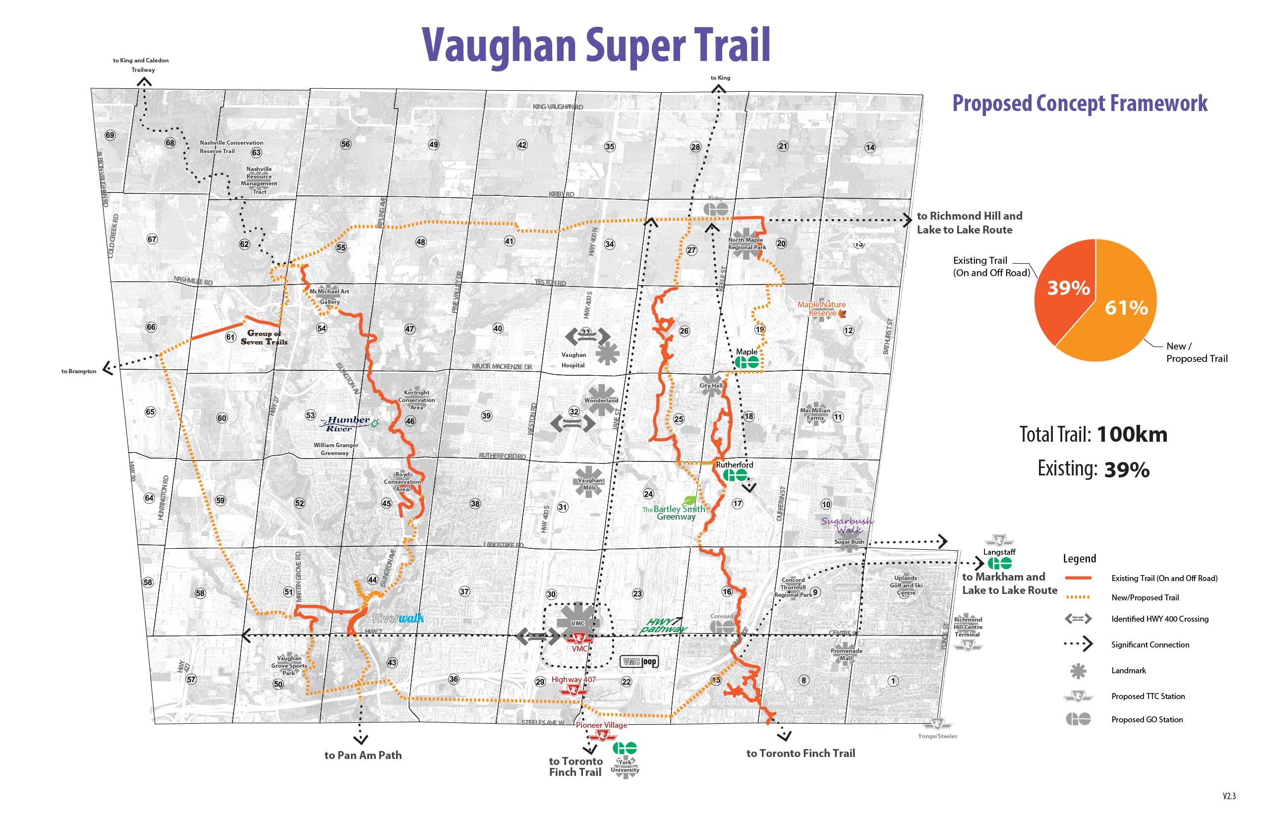
The Vaughan Super Trail is a bold initiative to create a world-class, identifiable trail that connects a variety of off-road pathways and on-road pedestrian and cycling paths. A key goal of the Vaughan Super Trail is to link communities and people with local nature, cultural heritage, communities and special destinations throughout the city of Vaughan.
The planned trail is a 100-kilometre city-wide loop system, adding to the 40 per cent of the trail that already exists. The Vaughan Super Trail initiative strives to contribute to the ongoing development of an integrated, accessible and sustainable city, placing Vaughan at the forefront in offering residents and visitors an enhanced quality of life while creating a variety of recreational opportunities and visitor experiences.
The City of Vaughan is moving ahead with various feasibility studies that will look at closing gaps or extending segments within the established trail networks.
The Bartley Smith Greenway
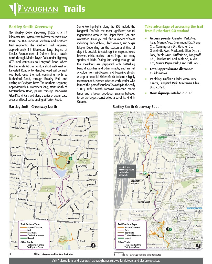
The Bartley Smith Greenway is a multi-use trail that connects the intersection of Teston Road and Cranston Park Avenue to the intersection of Steeles Avenue West and Dufferin Street along the West Don River. The trail is a combination of forested area and road connections that make up approximately 15 kilometres of recreational trail opportunities.
Download the Bartley Smith Greenway information sheet (PDF), including parks, community centres, washrooms, parking, transit and other points of interest along the greenway.
William Granger Greenway (Humber Trail)
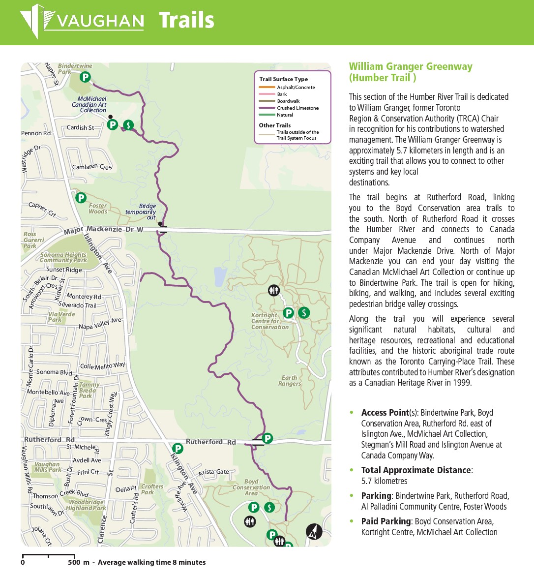
This section of the Humber River Trail is dedicated to William Granger, former chair of the Toronto and Region Conservation Authority (TRCA), in recognition of his contributions to watershed management. The William Granger Greenway is approximately 5.7 kilometres long and allows you to connect to other trail systems and key local destinations.
The trail begins at Rutherford Road, linking you to the Boyd Conservation area trails to the south. North of Rutherford Road, it crosses the Humber River and connects to Canada Company Avenue and continues north under Major Mackenzie Drive. North of Major Mackenzie, the trail ends at the Canadian McMichael Art Collection or provides the option of continuing up to Bindertwine Park. The trail is open for hiking, biking and walking, and includes several exciting pedestrian bridge valley crossings.
Moving along the trail offers the experience of several significant natural habitats, cultural and heritage resources, recreational and educational facilities, and the historic aboriginal trade route known as the Toronto Carrying-Place Trail. These attributes contributed to Humber River’s designation as a Canadian Heritage River in 1999.
The City of Vaughan has partnered with the Toronto and Region Conservation Authority (TRCA) to complete a feasibility study to explore ways to expand the Humber Trail and connect a seven-kilometre gap between Boyd Conservation Area and Steeles Avenue West.
The Nashville Conservation Reserve Trails
For information on the The Nashville Conservation Trails are opportunities visit the TRCA website.
Great Walks of Vaughan
Enjoy the outdoors and explore local neighbourhoods nature walks and trails! Download the Great Walks of Vaughan brochure or visit the Great Walks website for more information.


