Vaughan’s cycling network continues to grow
Image
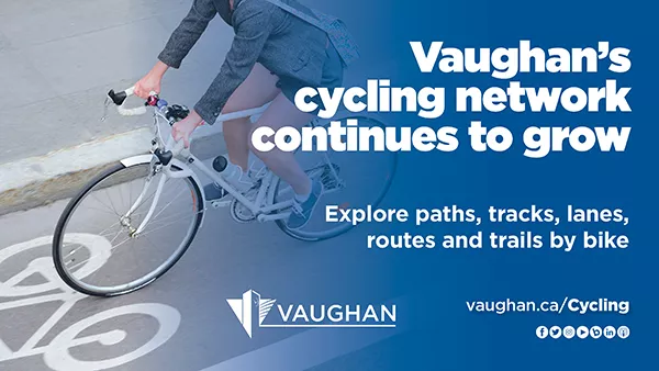
Explore paths, tracks,
lanes, routes and trails by bike
With a growing network of multi-use paths, tracks, lanes, routes and trails, the City of Vaughan is encouraging residents to get out and explore the community by bike. As more citizens choose cycling as a method of transportation, the City continues to expand its comprehensive transportation network to further promote a full range of options to get around, including walking, cycling and transit.
Enhancing existing multi-use networks and creating new active
transportation options contributes to a healthier environment and helps alleviate
traffic. They also bring the community together, establish transit connections
and get more people moving. The current cycling and multi-use network in Vaughan is growing and consists of six types of cycle
facilities:
- Multi-use recreational pathways: A recreational trail is an area completely outside of the road right-of-way and often passes through parks or other green spaces. Multi-use trails are designed for pedestrians, cyclists, in-line skaters and skateboarders and are located where trail surfaces permit these activities.
- Shared-use pathways: A shared-use boulevard path runs along the roadway but is separated from the traveled portion of a road by a curb or other physical barrier. Shared-use paths are intended for pedestrians and cyclists.
- Cycle tracks: A cycle track is a dedicated cycling area within the boulevard, separated from motor vehicles by a curb or a physical barrier. They are typically marked by a bicycle symbol and diamonds.
- Bike lanes: Bike lanes are designated for exclusive use by cyclists and located in traveled portions of the roadways. Either a painted line or hatched buffer separates cyclists from other motorists. Diamond pavement markings indicate the dedicated lanes, and bicycle symbols mark the type of vehicle it is dedicated for. Motorists are not allowed to park, stand or drive within a bicycle lane. Bike lanes are typically located on urban streets.
- Bike routes: Bike routes are areas where cyclists share the road with motor vehicles. They are typically marked with signage that could be supplemented by sharrows (a bicycle symbol and chevron combined, painted on the road). These symbols indicate a cyclist’s position within a lane; they serve as a reminder to drivers to expect cyclists and are sometimes used to guide cyclists through neighbourhoods. No physical changes are made to the roadway.
- Paved shoulders: A paved shoulder is a paved portion along a rural roadway outside of the motor vehicle lane. Paved shoulders can be used to accommodate cyclists on rural roads that generally have less than 10,000 daily vehicles and posted speed limits of less than 80 kilometres per hour.
A number of active transportation projects are underway. Vaughan’s
growing cycling and multi-use network aligns with the City’s commitment to
improve transportation and mobility, foster sustainable communities and create
an active, safe and diverse city – all priorities outlined in the 2018-2022 Term of Council Service Excellence
Strategic Plan. The following projects also support
the Vaughan Official Plan 2010 and the 2019 Council-approved Pedestrian and Bicycle Master Plan update.
VAUGHAN SUPER TRAIL
The planned Vaughan Super Trail is a 100-kilometre
city-wide loop system; this is in addition to the 40 per cent of the trail that
already exists. The initiative contributes to the ongoing development of an
integrated, accessible and sustainable city, placing Vaughan at the forefront
in offering residents and visitors an enhanced quality of life while creating a
variety of recreational opportunities and visitor experiences.
Vaughan staff continue to work on the Vaughan Super Trail planning,
design and development initiatives, including:
- completing the seven-kilometre Humber Trail feasibility study, connecting to the City of Toronto from Steeles Avenue to the Boyd Conservation Area Trail. A virtual public engagement session will be scheduled in the coming months.
- issuing an RFP in fall 2020 for a feasibility study along the Bartley Smith Greenway to fill a three-kilometre trail gap between Rutherford Road and McNaughton Road, utilizing the recently completed Major Mackenzie Drive pedestrian underpass.
- undertaking a feasibility study – in collaboration with York Region – for the South York Greenway Cycling and Pedestrian corridor in the vicinity of the Highway 407 corridor. When complete, the entire length of the South York Greenway will span approximately 40 kilometres from Vaughan to the eastern limits of Markham. The Vaughan corridor segment will span approximately 23 kilometres, with the first phase measuring approximately 11 kilometres between Jane and Yonge streets. The study is anticipated to get underway this year.
- undertaking a wayfinding and signage RFP – subject to budget approval – for the Vaughan Super Trail in 2021 that will provide a trail branding strategy, wayfinding and signage guidelines for recreational trail signage.
CLARK AVENUE CYCLE TRACKS
The
City is installing 4.5 kilometres of cycle
tracks on each side of Clark Avenue between Jason
Street/David Lewis Drive and Yonge Street. Once complete, the paths will:
- increase the amount of bike travel throughout the community.
- improve accessibility to schools, parks, libraries, community centres, places of worship and more within the Clark Avenue corridor.
- provide connections between the existing Bartley Smith Greenway Trail system and the Dufferin Street bike lanes to Yonge Street facilities and rapid transit.
THE VAUGHAN CYCLING NETWORK
The City has completed a number of active transportation
projects recently.
- Pedestrian and Bicycle Master Plan Update
- Cycling infrastructure within the Vaughan Metropolitan Centre along Millway Avenue, Apple Mill Road and Applewood Crescent
- In-boulevard shared-use pathway along McNaughton Avenue, between Major Mackenzie Drive and Keele Street
- In-boulevard shared-use pathway along Islington Avenue between Arista Gate and Rutherford Road
- Cycling facilities along Major Mackenzie Drive, from Pine Valley Drive to Highway 400 in collaboration with York Region
- Cycling facilities along the Bus Rapid Transit projects on Highway 7, Centre Street and Bathurst Street in collaboration with York Region and York Region Rapid Transit Corporation
- A pedestrian underpass beneath Major Mackenzie Drive west of Keele Street, in collaboration with York Region, to allow for safer crossing (this underpass also supports the future extension of the Bartley Smith Greenway, which will connect residential neighbourhoods to local commercial businesses)
Several dedicated cycling projects are currently
in progress:
- In-boulevard cycling facilities along Weston Road, from Major Mackenzie Drive to Teston Road
- The Keele Street shared-use pathway, from Teston Road to Kirby Road
- In boulevard shared-use pathway on Courtland Avenue, from Jane Street to Edgeley Boulevard
- In-boulevard cycling facilities along Martin Grove Road, from Steeles Avenue to Rainbow Creek Park
- The Jane Street active transportation feasibility review, from Apple Mill Road to Teston Road
- The Huntington Road detailed design plan from Langstaff Road to Nashville Road, including a shared-use boulevard pathway
As well, a number of current Environmental Assessment (EA)
Studies have incorporated cycling design criteria:
- The Bass Pro Mills Drive Extension EA Study from Highway 400 to Weston Road
- The Teston Road EA, 250 metres west of Pine Valley Drive to Kleinburg Summit Way
- The Kirby Road Widening EA Study, from Jane Street to Dufferin Street
- The Kirby Road Extension EA Study, from Dufferin Street to Bathurst Street
- The development of a collector street within the Concord GO Secondary Plan Area, from Highway 7 to Ortona Court
Cycling is a consideration in the following active
transportation projects in collaboration with York Region:
- Cycling facilities along Major Mackenzie Drive, from Highway 400 to Keele Street
- Cycling facilities along Major Mackenzie Drive, from Pine Valley Drive to Highway 50
- Cycling facilities along Rutherford Road, from Jane Street to Bathurst Street
- Cycling facilities along Teston Road, from Pine Valley Drive to Weston Road
- Cycling facilities along Bathurst Street, from Highway 7 to Teston Road
- Cycling facilities along Keele Street, from Steeles Avenue to Highway 407
- Cycling facilities along Dufferin Street, from Major Mackenzie Drive to Teston Road
- Cycling facilities along Dufferin Street, from Dufferin Hill Drive to Marc Santi Boulevard
- The Langstaff Road EA Study, from Weston Road to Highway 7
All active transportation development applications are
constantly reviewed by the City to ensure they include appropriate
facilities along Vaughan’s priority corridors in the final design.
OTHER TRAIL INITIATIVES
A number of community trail projects have been undertaken
by the City, including:
- building two pedestrian utility bridges, spanning the Purple Creek Valley in the Pine Valley Drive and Teston Road corridor, ranging in length from 185 to 238 metres.
- installing recreational trail connections within the Major Mackenzie Drive and Poetry Drive area.
- constructing five kilometres of granular trails within the new North Maple Regional Park, including walkway connections to adjacent neighbourhoods.
- implementing approximately 4.6 kilometres of asphalt and granular recreational trails throughout the Teston Road and Kleinburg Summit Way area, and on Major Mackenzie Drive within the existing hydro utility corridor, the Trans Canada Pipeline corridor and the edge of the valley within buffer blocks.
- constructing approximately 2.3 kilometres of recreational trail connections along each side of the existing CP Railway corridor, within the Major Mackenzie Drive and Baron Street area.
- executing a 400-metre-long asphalt trail connection into Doctors Mclean District Park from Islington Avenue, which will form part of the Riverwalk Trail in Woodbridge.
- commencing a master plan for the MacMillan Farm to provide public recreational trail networks throughout the site. The plan is being initiated in 2021 and will include public information sessions for input opportunities.
- working with the Toronto and Region Conservation Authority to develop an Active Transportation and Trail Plan for Vaughan's Sustainable Neighbourhood Action Program. This revitalization will improve sustainability, increase walkability, encourage cycling and create connections to existing trails, greenspace and more.
Current trail projects in partnership with Metrolinx
include:
- a 140-metre-long trail underpass structure and associated trail connections beneath the Metrolinx rail bridge, located south of Langstaff Road along the Bartley Smith Greenway.
- two pedestrian and cycling bridges across Major Mackenzie Drive and Rutherford Road to allow public access to the Maple and Rutherford GO Stations. This project is also in collaboration with York Region.
Current trail projects in partnership with York Region
include:
- a 46-metre-long and six-metre-wide asphalt trail underpass below Major Mackenzie Drive, which will be a significant underpass location as it fills in the gap in the Bartley Smith Greenway north-south recreational trail system and network in the Vaughan Super Trail.
- a feasibility study for the South York Greenway Cycling and Pedestrian corridor, in the Highway 407 area. When complete, the entire length of the South York Greenway will span approximately 40 kilometres from Vaughan to the eastern limits of Markham. The Vaughan corridor segment envisioned will span approximately 23 kilometres, with the first phase measuring approximately 11 kilometres between Jane and Yonge streets. The study will begin next year.
Other collaborations include:
- partnering with the Toronto and Region Conservation Authority on enhancements to the 1.3-kilometre granular trail connection between Kirby Road and Huntington Road in the Nashville Conservation Reserve. This will provide safe and accessible access into the reserve with connections to the local hiking trails.
- working with various external agencies on future trail planning and co-ordination of recreational trail opportunities in large infrastructure developments, such as arterial road widening projects and the Ministry of Transportation’s review of the Highway 427 Extension Project and the GTA West Corridor in northwest Vaughan.
VAUGHAN
METROPOLITAN CENTRE
The City has
approved the Vaughan Metropolitan Centre (VMC) Cycling Network Plan, which was
revised in February 2018. The plan includes the development of cycling
facilities along Highway 7, Millway Avenue, Applemill Road, Applewood Road and
Portage Parkway, with more dedicated bicycle routes and multi-use trails in the
design phase.
To support
the upcoming VMC Secondary Plan Review, the City has initiated a Transportation
Master Plan Update and the completion of two road environmental assessment
studies to build on and advance existing VMC cycling and pedestrian plans and
policies. The studies will help improve connectivity between major areas
including transit stations, schools, commercial areas and residential areas, in
addition to other community features such as connections to pathways and open
spaces.
The City is
also currently undertaking the VMC Parks and Wayfinding Master Plan, which will
support active transportation in the area. The study provides an innovative
framework, shapes development, promotes connectivity and defines how the VMC is
perceived and navigated. It also establishes a comprehensive public signage and
wayfinding system, which is vital for residents, businesses and visitors. With
this system, new and existing commuters will be better able to combine walking
and cycling with public transit, and customers will more easily find local
businesses, key destinations and institutions. This study is expected to be
completed in late 2021.
Stakeholder
and public engagement are paramount to the success of these studies. To help
complete and inform them, the City will be conducting various public feedback
opportunities in the coming months.
BIKE SAFETY TIPS AND ETIQUETTE
A bicycle is considered a vehicle under the Ontario Highway Traffic Act (HTA). This means cyclists have the same rights and
responsibilities to obey all traffic laws as other road users. A cyclist who
violates a traffic law can be stopped by a police officer, which may result in
a fine under the HTA. Cyclists have the following responsibilities:
- Stop at red lights and stop signs
- Signal all turns
- Have a white front light, red rear light or reflector, white reflective tape on the front forks and red reflective tape on the rear forks
- Have a bell or horn
- Wear a helmet if under the age of 18 (it’s the law)
Cyclists should also follow proper cycling etiquette,
including:
- keeping to the right.
- passing on the left when safe to do so.
- notifying pedestrians of approach with a friendly greeting or by ringing the bike bell.
- traveling in the same direction as motorists when riding on the road.
- stopping at traffic lights and stop signs.
- using hand signals to communicate intentions with motorists and pedestrians.
E-BIKES
E-bikes, which are
similar to bicycles, weigh less than 40 kilograms and require pedaling for
propulsion, may be used on all bike paths and trails. Scooter-style e-bikes,
and other motorized vehicles, are not permitted on pedestrian and bike paths,
sidewalks and trails. For more information about e-bikes in Ontario, please
visit the Ministry of Transportation’s webpage on electronic
bicycles.
To read more about bike safety, the City’s existing
cycling networks and new active transportation projects underway, visit vaughan.ca/cycling. A cycling map is available there.
Vaughan cycling facilities are also included in the York Region Cycling Map.
-30-