About Bartley Smith Greenway Trail
The Bartley Smith Greenway (BSG) is a 15 kilometre trail system that follows the West Don River. It is a recreational, multi-use trail that is a key component of the Vaughan Super Trail, a world-class 100-kilometre-long, city-wide trail network that connects users to nature, cultural heritage, communities and special destinations throughout the City of Vaughan. The trail system begins at the intersection of Steeles and Dufferin and reaches the north at Teston and Cranston Park. Future plans include extending the trail further north to Kirby Road.
Ward Boundary Review Background
Although the municipality began with all Members of Council elected at-large, a ward system was established in 1985. The configuration was modified in an Ontario Municipal Board (OMB), now known as the Local Planning Appeal Tribunal, order in 1994 from three wards electing a total of five Councillors to five wards, each electing one Councillor per ward. Some minor boundary changes were approved before the 2000 and 2006 municipal elections. A by-law passed by Council following a staff-run review was appealed to the OMB in 2009. The existing boundaries date from the OMB’s 2009 order.
Leaf and yard waste collection is ending soon
Follow
the City’s helpful tips for putting plants and branches to the curb
As fall comes to an end, so will the City of Vaughan’s leaf and yard waste collection service – which wraps up the week of Dec. 5, depending on your scheduled collection day.
Here are some last reminders before putting your materials to the curb:
Current Ward Boundaries
Vaughan's ward boundary map
Image
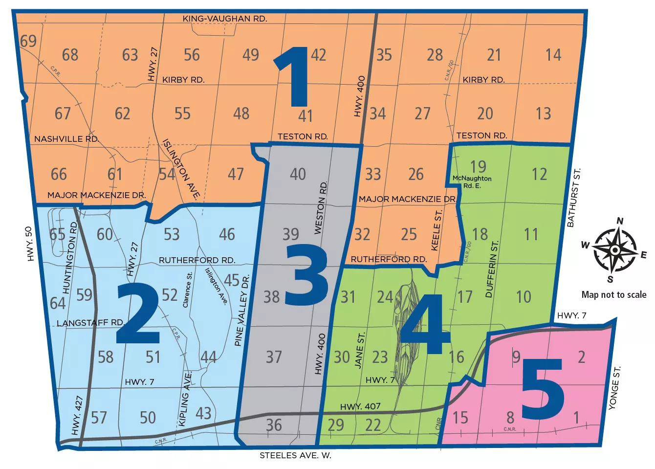
About Ward Boundary Review
The current five wards have been in place without significant change since 2009. This Ward Boundary Review is solely limited to consideration of the five ward boundaries. The review is not considering changes to the number of City Councillors.
Watch a video that explains ward boundaries and the review process.
Water, Wastewater and Stormwater Budget
Read the City's 2025 Budget and 2026 Financial Plan (PDF).